
Logging Geology — Strata, Details & Fractures

Updated: Sep 25
Geological descriptions are the core of any ground investigation log. In GneissFox, geology is recorded through several linked forms that follow the AGS 4.1.1 standard. This guide covers the Geological Description form (GEOL), Detail Descriptions (DETL), Discontinuities (DISC), Fracture Index (FRAC), and Fracture Spacing Min-Mode-Max.
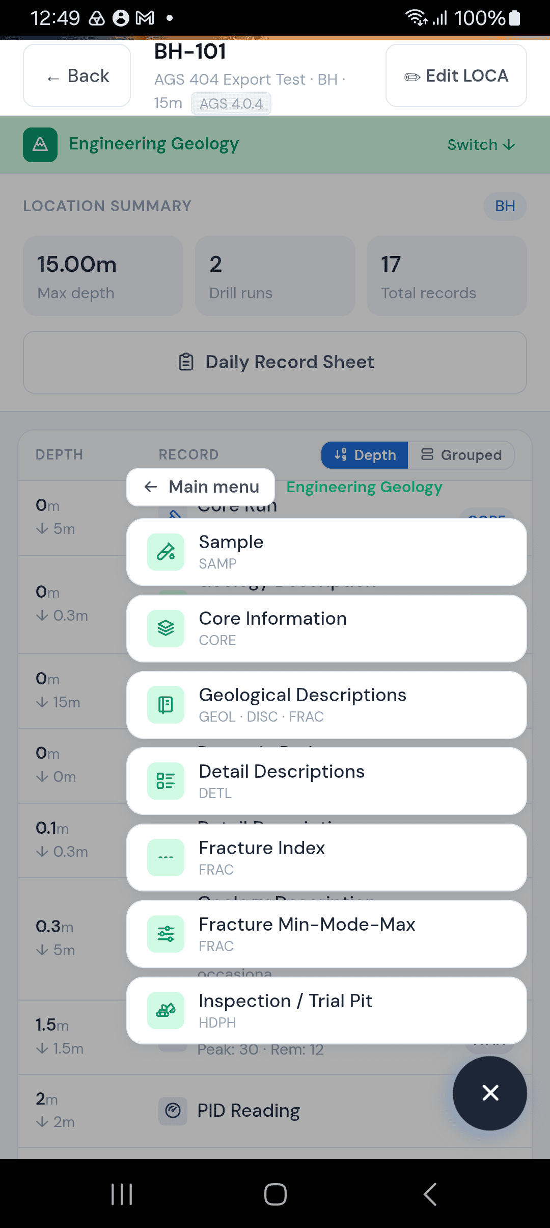
Geological Description (GEOL)
This is the main geology form. Each record describes a single stratum — a layer of ground with consistent characteristics across a depth interval.
Depth Top and Depth Base
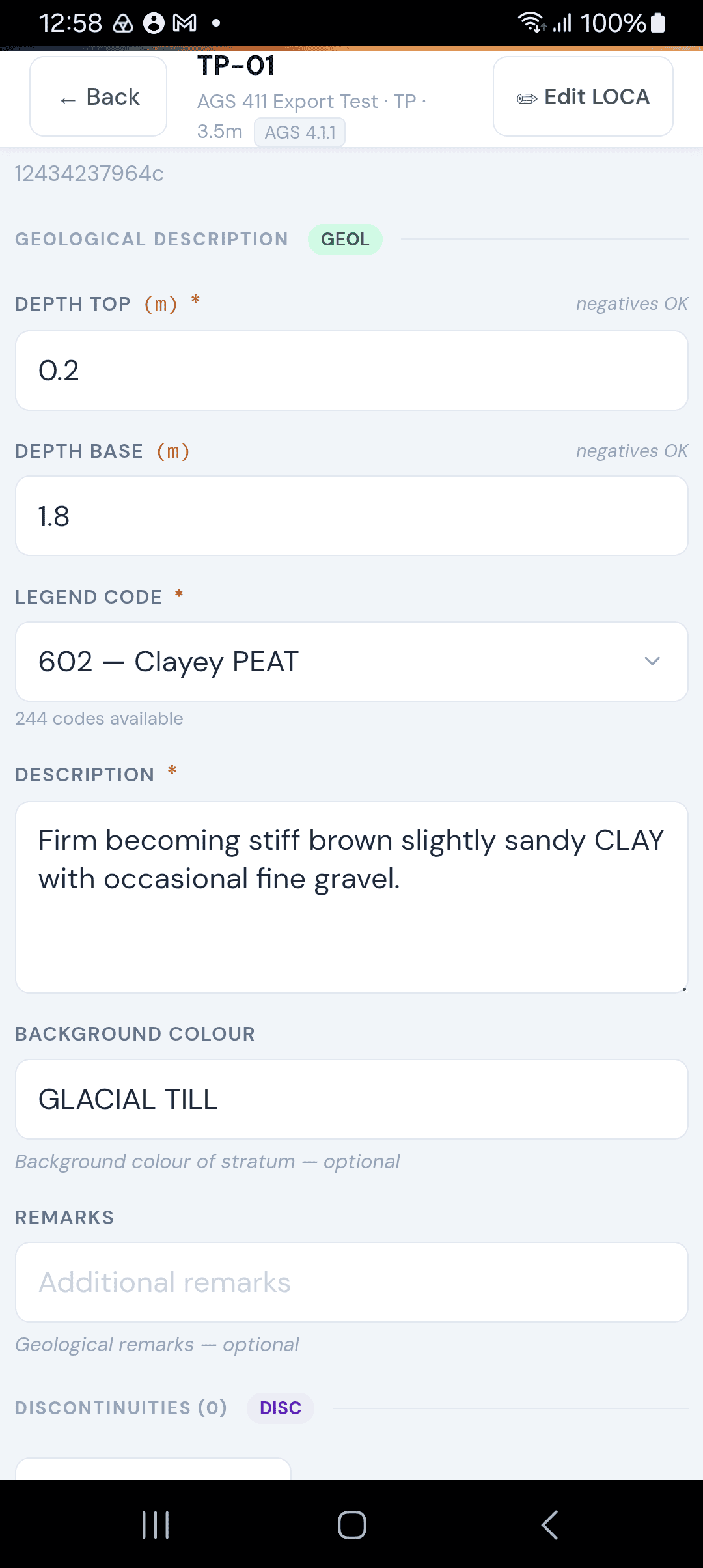
Enter the top and base of this stratum in metres. Both are required. Depth Top must be shallower than Depth Base. Negative values are allowed (e.g. for descriptions above datum).
Legend Code
Select a geological legend code from the searchable dropdown. There are 244 codes available, covering soils (clays, silts, sands, gravels, peats, cobbles, boulders), rocks (mudstone, sandstone, limestone, chalk, igneous, metamorphic), and special codes (made ground, topsoil, backfill, voids, no recovery).
You can type to filter the list — for example, typing 'sandy clay' will narrow down to matching codes. The legend code determines how the stratum appears on your borehole log.
Description
A full geological description of the stratum in plain English, following BS 5930 conventions. This is a required field. For example: 'Firm to stiff, dark grey, slightly sandy CLAY with occasional gravel-sized flints'.
Background Colour
The predominant colour of the material (e.g. 'GREY BROWN', 'ORANGE BROWN'). Optional but useful for the log.
Remarks
Any additional notes about this stratum. Optional.
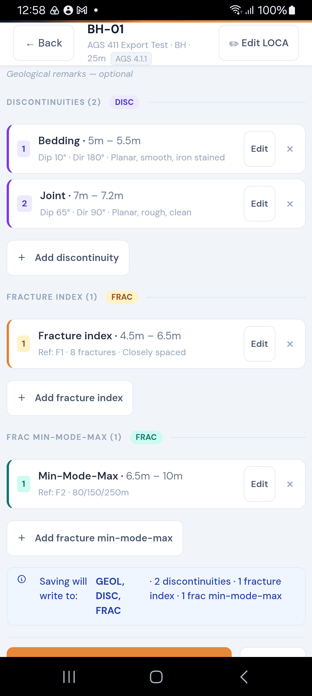
Discontinuities (DISC)
Discontinuities are features within a stratum that break the continuity of the ground — joints, faults, bedding planes, fractures, and similar. You can add as many discontinuity records as needed for each geological description.
Tap Add discontinuity to open the discontinuity form.
Depth Top and Depth Base
The depth interval over which this discontinuity occurs. These can differ from the parent GEOL interval if the feature only exists across part of the stratum.
Type
The type of discontinuity. This is required. Options include:
Bedding — Layering or stratification planes
Cleavage — Parallel fractures from tectonic pressure
Joint — A fracture with no displacement
Fault — A fracture with displacement
Fissure — A narrow crack or opening
Shear — A plane of shear failure
Fracture — A general break in the rock
Other — Anything not listed above
Dip Angle
The angle of the discontinuity from horizontal, in degrees (0° = horizontal, 90° = vertical). Optional.
Dip Direction
The compass direction the discontinuity dips towards, in degrees (0–360°). Optional.
Description
A free-text description of the discontinuity surface — e.g. 'Closed joint, planar surface, iron-stained'.
Fracture Index (FRAC)
The Fracture Index records how many fractures exist within a depth interval. This is primarily used in rock logging to quantify fracturing intensity.
You can add fracture records either inline within the geology form or as standalone records.
Discontinuity Reference
A reference identifier linking this fracture record to a specific set of discontinuities (e.g. 'G1-2 - 1'). This is required.
Depth Top and Depth Base
The depth interval being measured, in metres.
Number of Fractures
The total count of fractures observed within this interval. Used to calculate Fracture Index (fractures per metre).
Description
A description of the fracturing pattern — e.g. 'Closely spaced joints, mostly planar'.
Fracture Spacing Min-Mode-Max
This form records the statistical spread of fracture spacing within a depth interval. It provides a more detailed picture than a simple fracture count.
Discontinuity Reference
Same as the Fracture Index — a reference linking to the relevant discontinuity set. Required.
Depth Top and Depth Base
The depth interval being measured, in metres.
Spacing Min
The smallest fracture spacing measured within the interval, in metres.
Spacing Average (Mode)
The most common (modal) fracture spacing within the interval, in metres.
Spacing Max
The largest fracture spacing measured within the interval, in metres. Min must be less than or equal to Max.
Detail Descriptions (DETL)
Detail Descriptions allow you to record additional textual observations at specific depths, supplementing the main GEOL record. These are particularly useful for engineering geology logging.
Depth Top and Depth Base
The depth interval this detail applies to, in metres. Both are required.
Item Type
Categorise this detail. Options include:
Colour — e.g. 'Colour changes from grey to brown at 3.2m'
Texture — e.g. 'Becomes coarser grained below 5.0m'
Structure — e.g. 'Laminated between 2.0m and 3.5m'
Strength — e.g. 'Very stiff becoming hard below 6.0m'
Weathering — e.g. 'Highly weathered, grade IV'
Fracture / Jointing — e.g. 'Closely jointed, 50-100mm spacing'
Inclusion / Feature — e.g. 'Contains thin sand partings'
Other — Anything else worth recording
Detailed Description
The full description of this detail observation. This is required.
Remarks
Any additional notes. Optional.
Tips
You can add multiple discontinuities and fracture records to a single geological description — use the Add buttons at the bottom of each section.
The summary strip at the bottom of the form shows which AGS groups will be written (GEOL, DISC, FRAC) so you can confirm everything is captured.
Discontinuity and Fracture records open in a full-screen overlay to give you room to work.
You can edit or delete any discontinuity or fracture record by tapping it in the card list.
Legend codes are searchable — you don't need to scroll through all 244 options. Just start typing the soil or rock type.


Comments